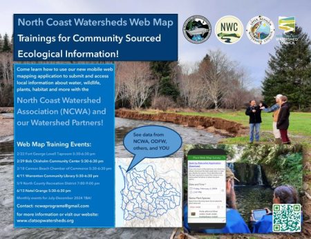
The North Coast Watershed Association (NCWA) and our watershed council partners are hosting a series of training events to teach our community how to use a new web mapping mobile application. This tool will help us collect and map community sourced information on water, plants, fish, wildlife, and habitat to scope for future watershed project opportunities.
The NCWA developed this web mapping tool to help the community both find and provide answers to questions like: Where have habitat restoration projects taken place in Clatsop County? Where are there pockets of knotweed? How warm does the lower Lewis & Clark River get during the summer?
Lots of ecological data exists out there but it can be challenging to find, and sometimes a local’s insight is the best (or only) information we have! This mobile web mapping application was developed to allow community members to share information about the land—like where you find a patch of the invasive plant Italian Arum or where you’ve seen steelhead running—and for the NCWA to share data from organizations relevant to water quality, past restoration projects, and more, all housed on a simple interactive map you access on your smartphone! Not only will this help everyone have a greater understanding of what’s happening in our watersheds, it also will allow the NCWA and our watershed partners the Necanicum Watershed Council, Upper Nehalem Watershed Council, and Nehalem Bay Watershed Council to more easily identify future restoration projects.